
Station Report
Geoid velocity added
To correct for the vertical drift between reference frames, the velocity of the geoid height (VN) is now calculated and incorporated into the calculation of the orthometric height. View documentation to learn more.
Site Identification
| Name | Province | NTS map sheet | Unique Number | Provincial Identifier | Network |
|---|---|---|---|---|---|
| IQAL CACS-GSD | Nunavut | 025N15 | M099002 | IQAL | CSRS |
Station Coordinates
Changing these fields will auto-update the station coordinate information below.
The velocities are interpolated from the national Velocity Grid version 8.0.
| Latitude | |
|---|---|
| Longitude | |
| h (metres) | |
| Vφ (mm/y) | |
| Vλ (mm/y) | |
| Vh (mm/y) | |
| X (metres) | |
| Y (metres) | |
| Z (metres) | |
| Vx (mm/y) | |
| Vy (mm/y) | |
| Vz (mm/y) | |
| Zone | |
| Easting (metres) | |
| Northing (metres) | |
| h (metres) | |
| Scale | |
| Combined | |
| Convergence | |
| N (metres) | |
| H (metres) | |
| Published date Project ID | 2024-11-21 M24-002 |
| VN (mm/year) | |
| VH (mm/year) | |
| Equipot. of geoid model (W0, m2s-2) |
Vertical Data (levelling)
Use the value of H from the coordinates above.
Vertical Datum Separation
Use the value of H from the coordinates above.
Location
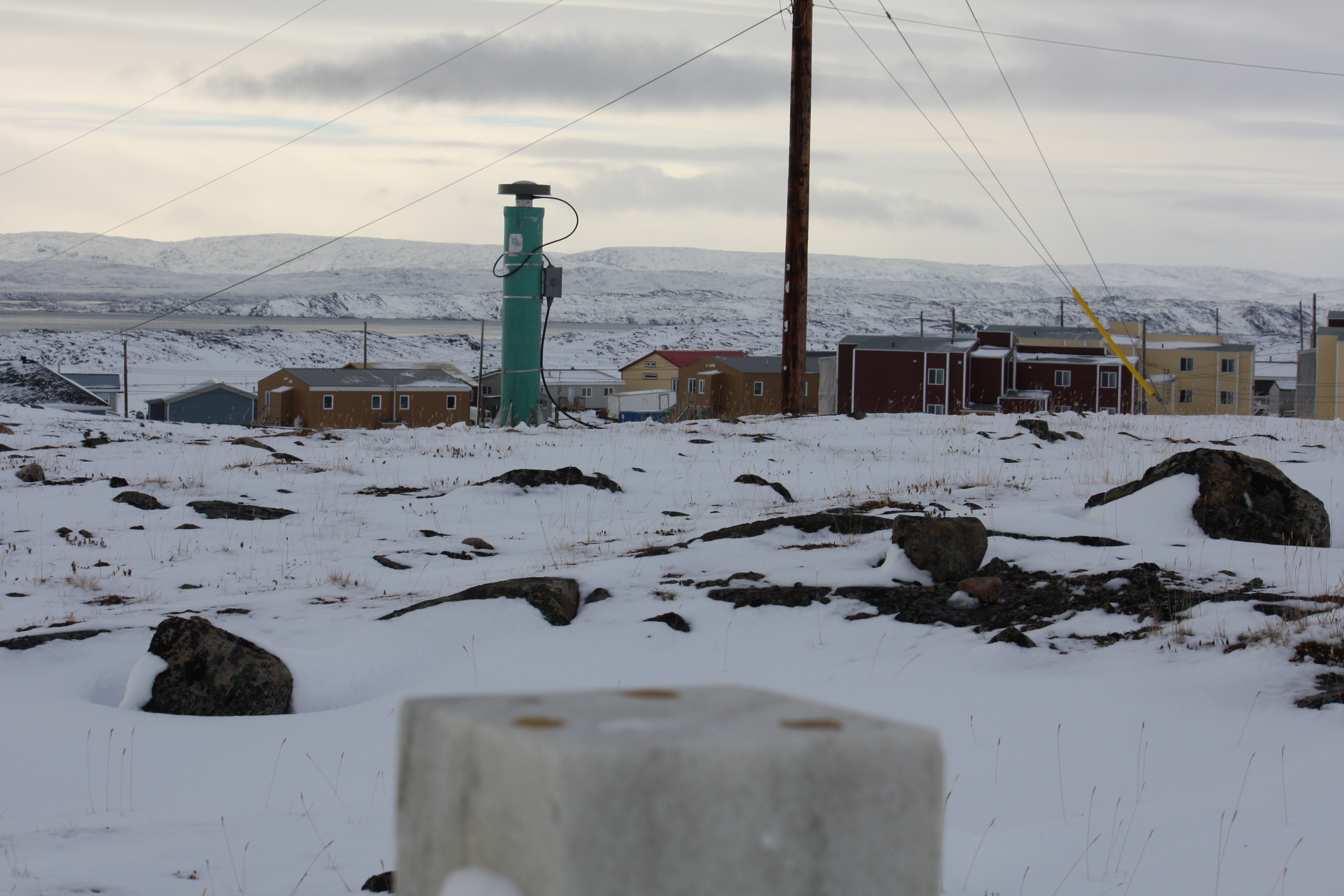
IQAL is a continuously tracking GNSS station and is part of the Canadian Active Control System (CACS). The station is located in Iqaluit, Nunavut.
The GNSS reference mark consists of an aluminum cylinder 1.8 m in height and 0.20 m in diameter, anchored to bedrock. The top of the monument is fitted with a welded plate and a centered 5/8th inch bolt.
Equipment on site
| Model/Type | Start date | |
|---|---|---|
| Receiver | SEPT POLARX5S | 2024-07-11 02:03:06 |
| Clock | Internal | 2013-08-19 14:15:00 |
Antenna
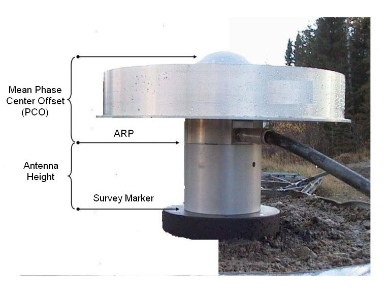
| Model | Start date | Height (m) | Phase center offset (mm) | |||
|---|---|---|---|---|---|---|
| GPS L1 | GPS L2 | GLONASS L1 | GLONASS L2 | |||
| TPSCR.G3 NONE | 2009-09-26 00:00:00 | 0.050 | 85.98 | 117.15 | 86.03 | 114.99 |
Use of Canadian Geodetic Survey products and data is subject to the Open Government Licence - Canada
- Date modified: